
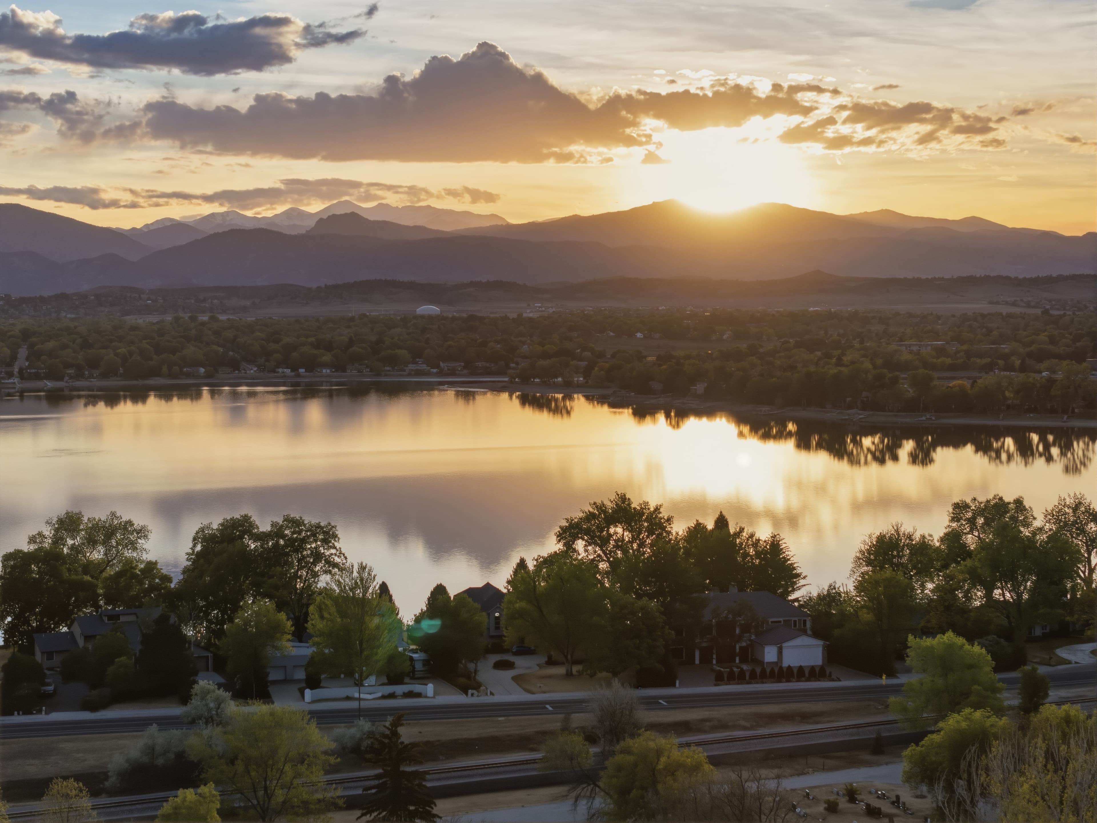
Drone Photography for Real Estate: Elevating Property Storytelling from Above
Quick overview: How one drone photo can reframe a listing
A single well-composed drone image can change how buyers perceive scale, access, and context. This guide explains when aerial imagery matters, how to brief and evaluate drone photography, and how to turn captures into measurable marketing value.
Why aerial imagery matters: What a good drone photo delivers
• Clarifies the property footprint and orientation at a glance.
• Establishes context: proximity to water, parks, views, or infrastructure.
• Demonstrates scale and relationships between structures, landscaping, and amenities.
• Creates cinematic entry points for listings and social that increase engagement when used thoughtfully.
• Reduces ambiguity for remote buyers and developers assessing parcels.
Who should invest in aerial imagery: Key use cases
• Agents marketing single-family homes with distinctive grounds or views.
• Builders and developers showing lot plans, phased communities, or construction progress.
• Designers and landscape architects documenting site context and before/after sequences.
• Commercial brokers illustrating campus layouts and access.
When to schedule drone photography: Timing and intent
• Pre-listing: create a polished first impression and set accurate expectations.
• Development milestones: masterplan reveal, infrastructure completion, show-home opening.
• Seasonal storytelling: peak landscaping, snow-free months, or autumn color.
• Lighting choices: golden hour and dusk for cinematic drama; overcast for even light and color accuracy depending on the subject.
Aerial shot strategy: Build a purposeful drone shot list
• Layered approach: capture three altitude layers—property detail, full-property footprint, and neighborhood/context.
• Essential angles: oblique front, oblique rear/amenity, top-down footprint, approach/driveway sweep, and context panorama.
• Property-type variations:
• Single-family suburban: front-entry sweep, backyard/pool nadir, property-line shots, street approach.
• Estate/rural: long-range approach to show access and parcel edges, outbuildings, water features.
• Urban condo/roof: building relative to skyline, rooftop amenities, proximity to transit nodes.
• New development: phased progress shots, lot cadastre overlays, amenity clusters.
• Deliverable-oriented shots: hero image for listings, small-crop social variants, wide panoramas for print, orthophotos for planning (if ordered).
Composition and visual principles for aerial photos
• Establish scale: include familiar objects (cars, people, trees) when appropriate to convey size.
• Lead with lines: driveways, shorelines, and roof ridgelines create compositional pathways.
• Horizon treatment: choose a low horizon to emphasize footprint or a higher horizon to emphasize views; keep horizons level.
• Negative space and breathing room: allow the property to sit in context rather than tightly crop unless detail is the intent.
Light, weather, and seasonal considerations
• Golden hour and dusk: richer color and long shadows for texture; effective for facades and water.
• Overcast days: soft, even light useful for color accuracy and reducing harsh shadows.
• Wet surfaces: can deepen color and reflections but avoid shoots right after unsafe wind or storm conditions.
• Wind and microclimates: higher wind reduces aircraft stability and usable shots—plan backups.
Technical and delivery specifications to request
• Photos: high-resolution JPEGs plus optional RAW for advanced editing.
• Orientations: both landscape and square crops for social platforms.
• Metadata: time, altitude, and compass heading for mapping and provenance.
• Color/profile: sRGB for web; request TIFF or Adobe RGB variants for print when needed.
• Video: 4K master, 1080p social cuts, and a 20–40 second cinematic approach clip when video is ordered.
Post-processing and ethical editing guidelines
• Prioritize honest representation: correct color, exposure, and lens distortion without altering property features or surroundings in ways that mislead.
• HDR and blending: use bracketing carefully to preserve highlights and shadow detail while avoiding unnatural artifacts.
• Corrections: horizon straightening and keystone correction can improve readability but should not change context.
Safety, compliance, and permissions: Practical checklist
• Confirm operator licensing and insurance—requirements vary by jurisdiction; verify locally.
• Secure property-owner permission and note privacy concerns from neighbors.
• Perform a site assessment: power lines, trees, and public restrictions influence shot selection and safety.
• Plan contingencies: alternate dates for weather and an on-site point of contact.
Pricing and packaging guidance: Presenting aerial services
• Offer tiered packages: basic aerial photo (1–3 hero images), premium (multiple altitudes + twilight), and production (photo + video + mapping).
• Make add-ons explicit: twilight/dusk shots, RAW files, geotagged orthomosaics, 3D models, and expedited turnaround.
• Align packages with property tiers and marketing goals rather than a one-size-fits-all rate.
Measuring impact: Practical KPIs for aerial imagery
• Listing engagement: page views, average time on page, and click-throughs from MLS and social posts.
• Lead quality: number and nature of inquiries attributable to listings with aerial imagery.
• Comparative tests: run A/B tests of listings with and without drone hero images to isolate performance differences.
Questions to ask a drone operator: Briefing template
• What equipment and gimbal will you use, and can you share recent sample shots from similar properties?
• Do you carry insurance and any required local certifications? Can you provide proof?
• What is your backup plan for weather, and what turnaround time should I expect?
• What exactly will you deliver (file types, counts, resolutions, metadata)?
• Can you execute a specific shot sequence or creative brief I provide?
Day-of checklist for the listing agent
• Confirm site access and notify neighbors if needed.
• Share a concise creative brief with the pilot: hero framing, three altitude layers, must-have amenity shots, and timing.
• Prepare the property: tidy driveways, hide cars if possible, and stage pool/amenity areas.
• Have an on-site contact and agree on a safety perimeter.
Example agent brief (copy/paste ready)
Please capture:
1. Hero oblique of the front façade at golden hour (wide framing, property centered).
2. Full-property overhead/top-down to show lot boundaries and landscaping.
3. Backyard/pool nadir and oblique showing outdoor living and orientation to the sun.
4. Neighborhood/context panorama showing proximity to park, water, or transit.
Deliverables: 5–8 high-resolution JPEGs, 1 RAW set, and a 20–30 second cinematic approach clip. Turnaround: 48–72 business hours.
Common pitfalls and how to avoid them
• Over-reliance on one high-altitude shot: pair it with lower-altitude detail shots to avoid misleading scale or usable space.
• Poor weather choices: midday harsh shadows or high wind can ruin footage; schedule contingency dates.
• Unclear briefs: provide a short, prioritized shot list tied to marketing outcomes.
Next steps to integrate aerial imagery into your marketing
• Pilot a two-listing experiment: compare one listing with standard ground photos to one that adds an aerial hero image and compare KPIs.
• Create a one-page aerial deliverable guide to share with vendors and clients so expectations are consistent.
• Maintain a short gallery of best aerials to use as examples when briefing photographers.
Closing: Practical takeaways on drone photography
A thoughtfully executed drone photo is a strategic asset that clarifies property value, accelerates understanding, and elevates storytelling. Approach aerial work with a clear brief, attention to safety and local rules, and an eye for composition; it will repay the investment in both clarity and engagement.